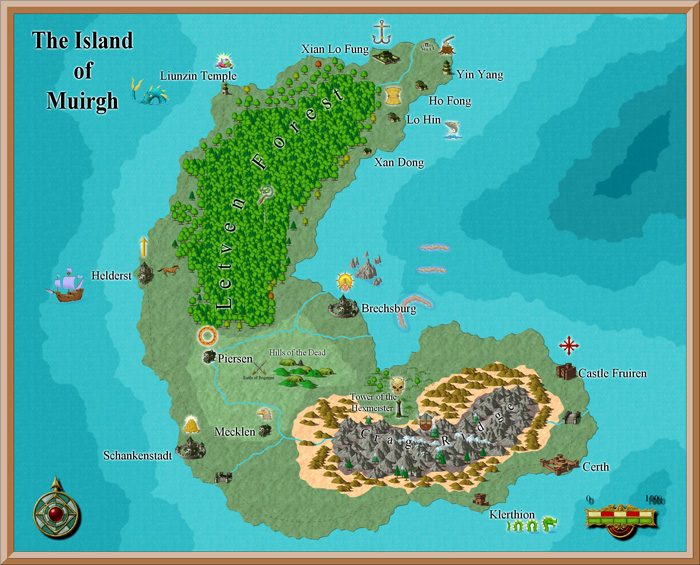
map creation?

The mountain is in a stretch of mountains, nearish the end. Soz i ment 1000m :eek: (well around that as i dont exactly give any real measure to it). It doesnt really matter as it is fantasy so anything can happen
 
igloo15 : Glad to hear they are of help. yes I hoped to have done them all by now. Sorry.

Bit snowed under at the moment with the day job, however you can play around with the following, and you'll soon get the idea how it's done..

1: get your Alpha B&W map as you base layer
2: on a new layer above it, fill in with black or white
3:Make sure your selected colours in your tool palate are B&W. Then go Filter>Render>Difference Clouds. Then Hit Ctrl+F about 6-10 times.

This will be your grey scale height map for the mountains and valleys. White is high, Black is low. try Inverting this grey scale to see if you like it that way better.

4: do this test on your new height map - Filter>Sketch>Bas Relief. Play around with the settings of lighting and detail etc. This is the 3D look.

5: To get it on your map, go back to your B&W version.

6: select the land areas, create new layer and fill in green
7: Invert select and fill water in blue
8: with the sea an lakes still selected, go to your Bas Relief layer and click delete so you're left with just the land masses with bass relief
9:On your Bas Relief layer (assuming it's above your colour one) choose Overlay as the layer blend.

Thats the basic version. Ideally you need to work into the result from step 3, using your selection to get the land masses, and use your paintbrush, dodge & Burn tools to edit , lowering the coast lines with black, or to build up mountain ranges with white. You can also cut and paste bits you like around, and use the blending modes in the layers palette to get a final result.

You can also work into step 6 by painting in green>yellow>white depending on the heights or types of terrain. Take a look at a colour atlas to see what I mean.

For the colour heights, don't worry about details, you can paint in the colours roughly. Use your height map as a guide where to line up the snowy mountains, and then when you're happy with your areas, use Filter>Blur>Diffuse blur to help make a gradient to your peaks - though make sure you have your land masses selected before you do this to it will blur into the sea.

It's pretty easy really, the skill is in the editing and manipulation you might want, otherwise it can end up looking like crumpled paper or tin foil.

I'll do a proper tutorial when I get some time, probably next week....Hopefully :)

Have fun!

Jez
 
Hi jezelf,

Thanks for everything you've posted, but I'm having problems with the following, if you could help me.

select layer with map > Ctrl+A (select all) > Ctrl+C > Channels tab > create new alpha layer > Ctrl+V to paste.


Maybe my adobe is an early version, but after I select *layer* I can't find *map* so therefore I can't create the alpha layer. Everythings good to there. Any suggestions? Much obliged.
 
he means select the layer with the black and white map you created. Then hit ctrl a to select it all. Then ctrl c to copy it. Then go to channels create an alpha channel by hitting th buttom at the bottom of channels. Then select the alpha channel and hit ctrl v to paste the map on to it.
 
Hi there. Are you trying to create the second tutorial before creating the first(basic map)? You won't find *map* if you're working on the second tutorial first.

Of course if you have got that then Igloo15 is right, yes. Plus what version of PS are you using?

There is one Photoshop wich is sometimes shipped with printers which is more a home photo editor and not as powerful as Photoshop CS (or PS3 upwards) I can'tremember what it is called. Are you familiar with the User Interface?

Map01_1_3.jpg

You should find the above palette in Photoshop as standard and there you can see channels tab.​

in the channels click on new layer to create a new alpha layer which should look black and it'll autoname it 'Alpha 1'.​

select this layer and then paste your map in there. You then click back to the layers tab and work on that.​

Happy to help if you want more info.​
 
hey there,

its been a while. I was hoping to do more tutorials, but I don't think I'm going to get it done this year as I have so much other stuff going on demanding my time.:(

However I actually found this link today! :) same thing for the 3d landscape....

» Rendering a map using relief shading technique in Photoshop

relief-shading7.jpg


I hope to continue tutorials next year ,but to be honest, the above tutorial is just the same, if not better result than what I had in mind.

Cheers
jez.
 
Hey JDP

You could do a few things. There’s the technique I've mentioned in brief above . May not give you exact results, but with some time and effort it should possible to get something decent.

or, if you want to get something more accurate - and authentic to real world geography - you could grab some of the height data from the NASA sources (check the copyright small print, but sometimes there is none), or check out the links for height map "Generating software" on wikipedia. With these, you can play about create a mountain range etc in the program, then render out a height map that you open up in Photoshop to cut and paste bits you like the look of to fit into your own map.

or try using something like Terragen , a scenery generator for Windows and the Mac OS. Terragen is free for personal non-commercial use.

I haven’t used it myself yet (just downloaded the Terragen 2 demo) - but with this kind of program, you should be able to export height map information, which in a program like Photoshop, you could cut and paste into your alpha map.

I'm hoping to find some time in the coming months to explore as couple of these techniques and put them in a tutorial - I'll probably try using something which is freeware or free to download for personal use.

Hope that helps
good luck!
Jez

EDIT: JDP, Is your existing alpha map fictional or real world? If fictional then all the above should help you. With real world, check out the NASA stuff , DEM (Digital Elevation Map) as mentioned in my last post. I haven't had time to look through all this myself yet but I will when I get round to the tutorials.
 
Last edited:
hey earlier there was a post with a link to a font site that had a font called Hill Country. Just wanted to tell people that I downloaded it and I'm now using it for EVERY fantasy map I create :D It is the best tool I have ever found.

But does anyone have one for trees? :eek: It's a right ******* to draw good trees on something as primitive as paint.
 
terragen is free for personal use and could be used to get the geography sorted out as a reference source for you.

if you were to pay for the commercial version, you could use it for making maps for illustrations or even full renders for cover artwork
 
found this today - might help with map making

Not that I really want to plug some software, but look at it as another resource. It's a software called Campaign Cartographer and it's aimed at desktop Roleplaying Dungeon Masters for their quest campaign - but it might help create maps for your fantasy novel. You don't need Photoshop as in the other stuff I've mentioned before. Probably helpful if you don't consider yourself as being very artistic or can't get your hands on suitable art software.

There isn't a downloadable demo yet to try it out, apparently they are looking into that, but you can look through their gallery of maps.

ProFantasy Software - Campaign Cartographer 3 - map making for game, historical and hobby mappers

ProFantasy Software - Reviews - map making for game, historical and hobby mappers


gallery05.jpg


"
CC3 is the fastest and most powerful map-making software for gamers. So if you're a busy person who wants the best, this is the software for you. In minutes you can learn all you need to rapidly create beautiful maps for campaigns, games and even real-world applications. "
 
Last edited:

Similar threads


Back
Top